- Region
- Vega baja
- Marina Alta
- Marina Baixa
- Alicante
- Baix Vinalopo
- Alto & Mitja Vinalopo
-
ALL TOWNS
- ALICANTE TOWNS
- Albatera
- Alfaz Del Pi
- Alicante City
- Alcoy
- Almoradi
- Benitatxell
- Bigastro
- Benferri
- Benidorm
- Calosa de Segura
- Calpe
- Catral
- Costa Blanca
- Cox
- Daya Vieja
- Denia
- Elche
- Elda
- Granja de Rocamora
- Guardamar del Segura
- Jacarilla
- Los Montesinos
- Orihuela
- Pedreguer
- Pilar de Horadada
- Playa Flamenca
- Quesada
- Rafal
- Redovan
- Rojales
- San Isidro
- Torrevieja
- Comunidad Valenciana
Hiking in the Sierra de las Pansas in Yecla
A 2-hour walk in the mountains the Sierra del Carche in southern Yecla
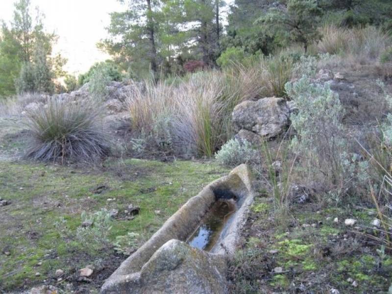 The Sierra de las Pansas is a group of mountains on the north-eastern side of the Sierra del Carche which is separated from the main bulk of the higher ground by the gorges of Barranco del Saltador and Barranco de la Yedra. It forms part of the regional park of Sierra del Carche and, unlike the rest of the park, lies within the municipality of Yecla (rather than Jumilla).
Las Pansas is densely wooded and features gorges and peaks which rise above the pine forest to a maximum altitude of 1,036 metres above sea level, and within this rocky ground are caves like the one which was reportedly used as a hideout by the bandit Jaime el Barbudo in the early 19th century.
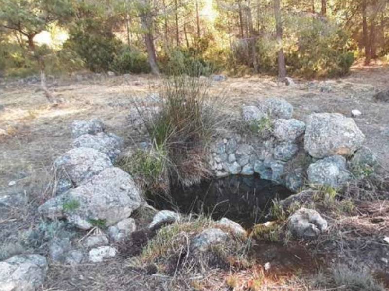 Some parts of the sierra have been reforested but most of the vegetation is 100% natural, covering the north-facing slopes with pines and holm oaks as well as thick undergrowth, and this habitat is hope to animals such as wild boar, toads, genets, badgers and a wide variety of birdlife.
Within this thickly wooded environment are a number of paths which lead up the mountains to the peak, and one popular route follows a circular path including the “Fuente de las Pansas”, a natural spring which in Roman times was an important water source which fed into a small storage system and a series of distribution channels.
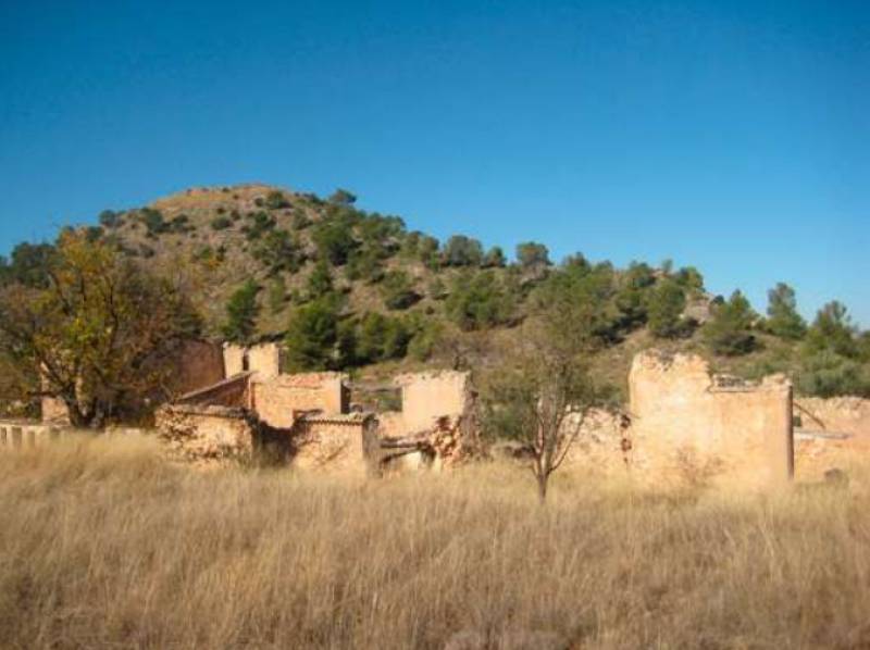 At the very top of Las Pansas, behind the ruins of Venta Pelavivos, are the remains of a circular wall which enclosed a Bronze Age settlement in the 2nf century BC, while the Barranco del Saltaor is nowadays used for recreational canyoning.
Access
At km 19 on the RM-424 road to Pinoso is the hamlet of Venta de las quebradas and the junction of the A-15a to Jumilla. At km 16 of this road are the ruins of the Venta Pelavivos, and from here runs the path which leads to the northern side of Sierra de las Pansas, where the route starts.
From here walk to the old Fuente de las Pansas and then take the right fork onto a path through thick vegetation and the higher ground of the Seirra. Here there is a crossroads: take the path on the left to continue the ascent to the marker at the peak.
Initially the descent is fairly flat but it soon steepens before taking walkers back to the Centa Pelavivos after a hike of around 2 and a half hours.
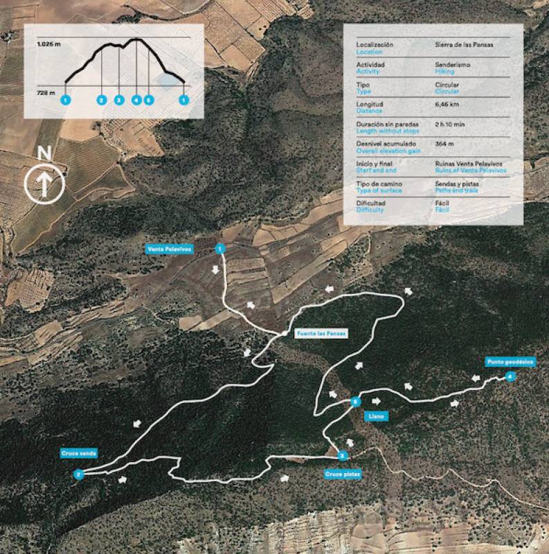 A pdf presentation of this hike is available here and further details can be found on Wikiloc here.
If visiting Yecla don’t forget to make sure one of your first ports of call is the tourist office (Plaza Mayor, 1, email turismo@yecla.es, telephone 968 754104).
For more local visiting information, events and news go to the home page of Yecla Today.
staff.inc.ali
Oficina de Turismo de Yecla
In early 2025, due to renovation work at the usual office, the service is located on the other side of the Plaza Mayor at Calle Epifanio Ibáñez nº 2 (click for map).
 Yecla is a large municipality in the north of the Region of Murcia, home to just under 35,000 people, and these days is best known for its wines, which enjoy Denomination of Origin status, and its furniture production, which has its origins in the abundance of pine trees on the mountainsides and the high plateaux.
 While visitors in the 21st century may be attracted primarily by wine tourism, the town (or city, as it was proclaimed in 1878) also has a wide historical, cultural and natural heritage, and an identity quite different from the coastal areas of the Region of Murcia. For this reason it is often grouped together with its neighbour and fellow wine-producing area Jumilla as part of the Altiplano area.
Yecla borders with Castilla-La Mancha and the Region of Valencia and is closer to Alicante coastal areas than much of Murcia. These visitors come to see the historic old town itself - an atmospheric and interesting place, crammed full of history - the natural beauty of Monte Arabí, with stunning views for those who enjoy the outdoors, the gastonomy and of course the wine route.
 Yecla boasts cave paintings from 10,000 years ago in Monte Arabí, a Bronze Age settlement at El Arabilejo, Iberian remains in El Pulpillo and a Roman administrative centre at Los Torrejones as well as the remnants of the 11th century Moorish castle on the hill behind the town. More modern (and complete) testimony to the past are the buildings in the town centre, which include the grandiose Basílica de la Purísima, with its striking blue dome, the archaeological museum and the attractive Plaza Mayor, where the 16th century Town Hall stands alongside the Renaissance Casa de los Alarcos, the clock tower and the old grain store.
 The tourist office holds a full selection of leaflets, maps, pre-planned routes, accommodation and restaurant options and information about visiting Yecla for both individuals and groups.
There is parking close to the tourist office, although those driving to Yecla for the first time are advised to park in Calle Perales.
For further information go to the home page of Yecla Today.
Opening hours:
Tuesday to Friday 8.00 to 15.00
Saturdays 10.30 to 14.00 and 17.00 to 19.30.
Public holidays 10.30 to 14.00
Click for map, Yecla tourist office


