- Region
- Vega baja
- Marina Alta
- Marina Baixa
- Alicante
- Baix Vinalopo
- Alto & Mitja Vinalopo
-
ALL TOWNS
- ALICANTE TOWNS
- Albatera
- Alfaz Del Pi
- Alicante City
- Alcoy
- Almoradi
- Benitatxell
- Bigastro
- Benferri
- Benidorm
- Calosa de Segura
- Calpe
- Catral
- Costa Blanca
- Cox
- Daya Vieja
- Denia
- Elche
- Elda
- Granja de Rocamora
- Guardamar del Segura
- Jacarilla
- Los Montesinos
- Orihuela
- Pedreguer
- Pilar de Horadada
- Playa Flamenca
- Quesada
- Rafal
- Redovan
- Rojales
- San Isidro
- Torrevieja
- Comunidad Valenciana
article_detail
A great car or bike tour of unspoilt coastline and countryside in the east of Aguilas
A rare stretch of undeveloped Mediterranean coastline with a backdrop of spectacular cliffs and mountain scenery
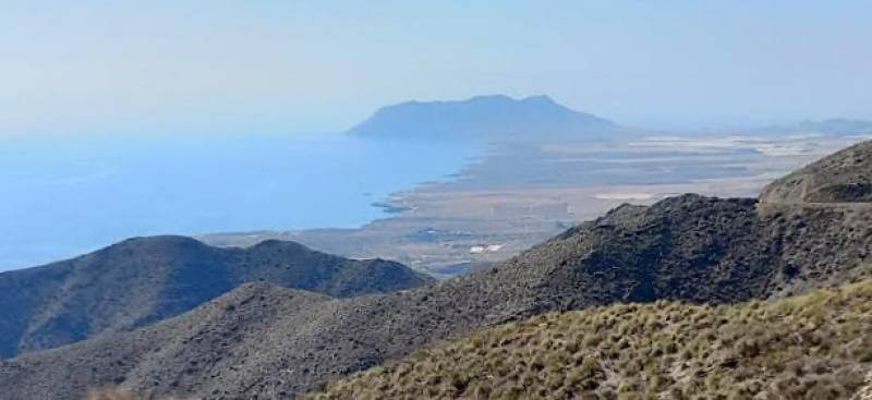 The area of the municipality of Águilas which runs north along the coastline from the imposing headland of Cabo Cope to the boundary with the municipality of Lorca is one which has almost miraculously escaped the attentions of mass property developers over the last 50 years, with regional and national legislation preventing all attempts to capitalize on the glorious coastline and still largely unspoilt countryside.
 The coastline here is spectacular, and few would argue that one of the pleasure of visiting the town of Águilas is taking a leisurely detour on the way there to see one of the last remaining stretches of Mediterranean coastal land in Spain which has not fallen victim to the mass urabnization of rural and agricultural land!
One of the best ways to enjoy the area is to approach Águilas from the east, and for those coming from Mazarrón and Cartagena it is advisable to take the RM-332 road from Mazarrón to Águilas, rather than the AP-7 motorway – this will give you time to appreciate the changes in the landscape, rather than zooming through them at 120 kph! Join the RM-332 either just outside Mazarrón itself, at the roundabout where the RM-3 motorway from Camposol and Condado de Alhama ends, or further west by coming off the AP-7 at km 857, signposted Cañada de Gallego, Ramonete and Puntas de Calnegre.
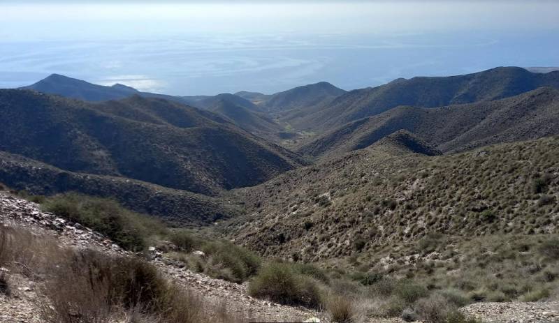 Continue along the RM-332 until turning left (again assuming you are coming from Mazarrón) onto the RM-20, signposted Cabo Cope – this is the road which will lead you up into the mountains and where a stop is thoroughly recommended to take in the breathtaking views over the sea. Warning: this can feel slightly scary on windy days!
Then it’s back in the car and down to the coastal plain, where had the developers had their way there would now be golf courses, hotels and an inland marina which would have driven naturalists insane! Instead there are acres and acres of crop fields, as one of the pillars of the economy is the melons, tomatoes and many other fruit and vegetable crops which find the soil and climate of Águilas ideal.
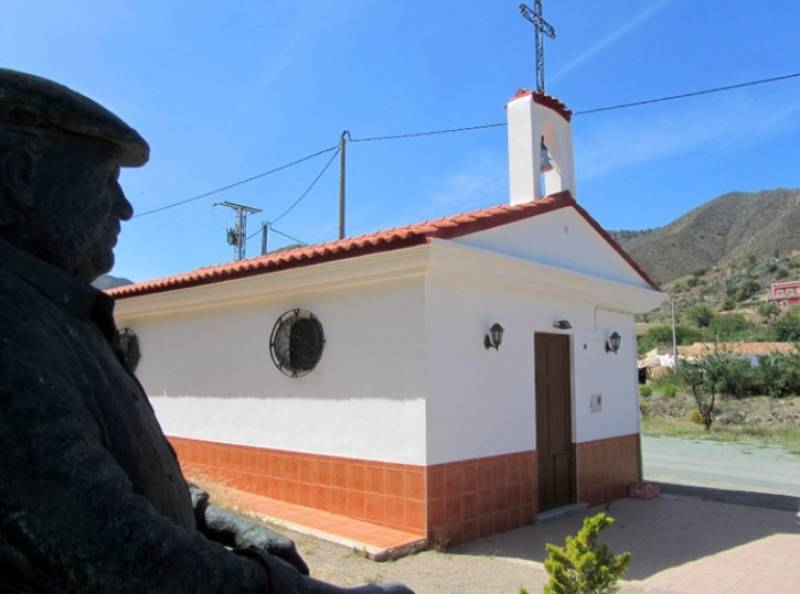
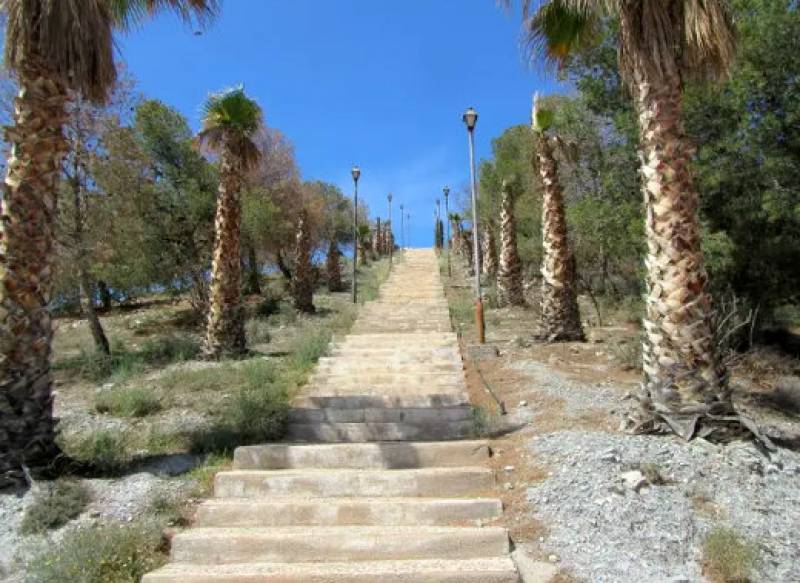 Before reaching the coast, it’s worth stopping at a couple of places of interest along the way. First, park alongside the small church of El Garrobillo and take a look at the “Cabezo de la Cruz”: this is an unusual flight of steps leading up to the top of the hill, where a cross bears the legend “Esta cruz vencerá” (This cross shall triumph). It’s a slightly strange thing to find in the middle of the crop fields, but the church and the Cabezo de la Cruz are the centre of the local fiestas every 8th December, when in honour of the Our Lady of the Immaculate Conception, the locals gather and join in various games and activities, including one known as the “Rama de Tomate”, where a prize is awarded to the person who has grown the best tomato.
Music is provided by the local “cuadrillas de animeros”, traditional folk music and dance groups, and on the national holiday of 8th December hundreds of people attend Holy Mass before parading with the figure of the patron around the church and up to the top of the staircase.
After your brief climb, get back to the car and instead of carrying on to the coast, take the small road on the right (the RM-D14) which leads towards the mountains, signposted Cuesta de Gos. Cuesta de Gos is a tiny hamlet consisting of no more than a few houses in a small valley at the foot of the mountains, but in this valley there is plenty of greenery including pomegranate and other fruit trees, and it enjoys a fame far greater than its actual size and population.
 This is because it was the birthplace of actor Paco Rabal, who was born on 8th March 1926 but whose family soon left the Region of Murcia when the Civil War broke out in 1936 and moved to Madrid. He soon became interested in the theatre and went on to become one of Spain’s best-known and best-loved actors, starring in many films including “Los Santos Inocentes”, for which he won the Best Actor award at the 1984 Cannes Film Festival.
Among the anecdotes concerning his career is that he was originally director William Friedkin’s first choice for the role of the French villain in The French Connection, but his staff mistakenly hired fellow Spanish actor Fernando Rey for the role.
In his later years he took up residence close to his birthplace in Calabardina. The Centro de Cultura in Águilas is named after him and at the small church of Cuesta de Gos is a charming statue of the great man as he appeared in some of his last films, sitting on a chair and quietly contemplating the countryside around him. It’s a charming and little seen tribute to a man who made his way from extremely humble beginnings to become one of the most widely respected actors in continental Europe.
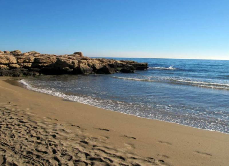 Now, back down to the RM-D14 and on towards Águilas – but not for long! Soon the road veers right at the El Pocico bar and restaurant, where free guided walks along the coastline start every month (the next is on 10th December), and just a couple of hundred metres further on take the left turn onto the RM-D15 towards the coast.
This is not signposted and indeed it looks at first like just another farm track, but if you are following a line of electricity pylons then you’ve got the right road! You’re now heading down towards the beaches and coves of eastern Águilas, reaching the shore first at Playa del Rafal and then, turning right and heading south, Playa del Charco and Playa del Sombrerico. These are not the northernmost beaches in Águilas, but to reach the others the drive really is through melon fields on dirt tracks!
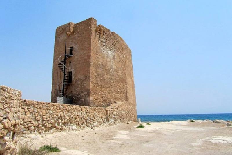 While driving along the coast the majestic headland of Cabo Cope looms nearer and nearer, and its foot is a small watchtower which was built in the 16th century as part of the defences against the Berber raiders from north Africa. Alongside are the remains of a tiny hermitage which also dates from the 16th century.
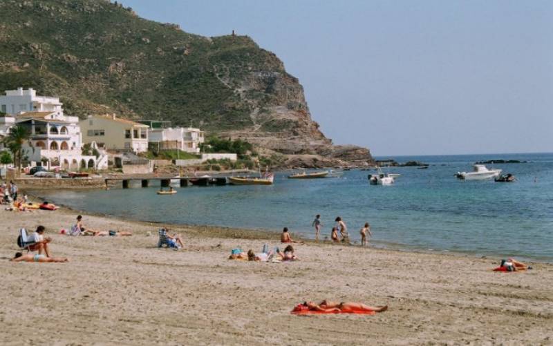 From here follow the road to the village of Calabardina, a lovely little spot which has become very popular with summer tourists and foreign residents in recent years. It is now a thriving community and boasts a beautiful beach and bay in the corner beneath Cabo Cope.
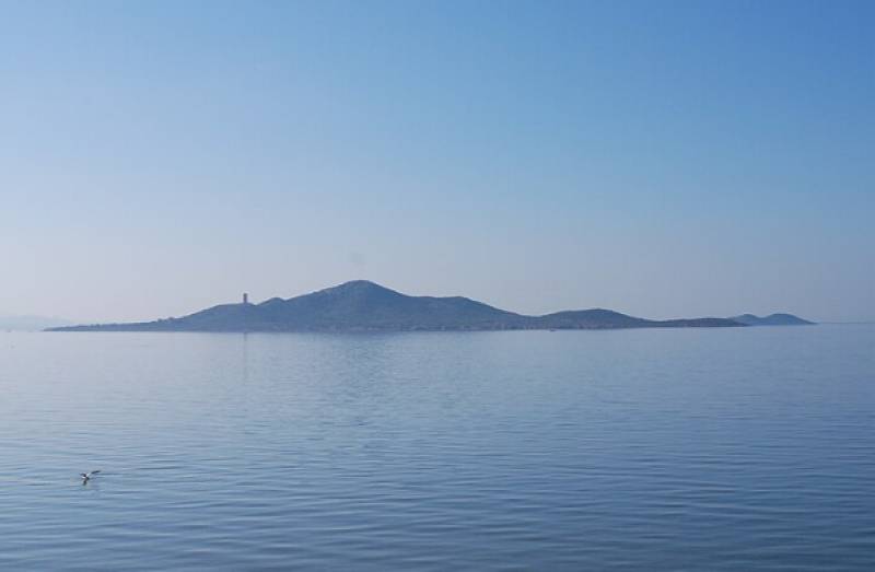
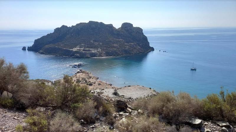 Now we’re nearly in Águilas, although as the road continues to hug the coastline you might enjoy stopping to drive through the Isla del Fraile development to drop down to the Playa Amarilla and the island itself, where recent excavations have revealed a rich historical heritage dating back to the Bronze Age. This is a lovely little beach and a great place to go snorkelling around the island!
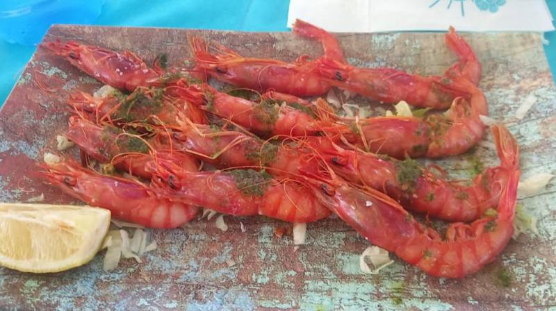
And with that, it’s on to Águilas, where if you’ve spent the morning driving and touring there is no doubt you’ll be ready to sample the local gastronomic treats – for seafood lovers, you certainly can’t do much better than a plate of the delicious Águilas red prawns, washed down with the beverage of your choice!
 Once in Águilas, though, your first port of call should be the local tourist office for advice on what to see and do before you head home or to your accommodation for the night!
For more visiting information, local news and events go to the home page of Águilas Today
staff.inc.ali
Loading
Contact Murcia Today: Editorial 000 000 000 /
Office 000 000 000


