


PROPERTY SEARCH


Wintery weather arrives in Spain: Weather forecast October 27-30
Several stormy fronts will bring widespread rain to much of Spain this week
Weather outlook on Wednesday afternoon, October 29
October is set to draw to a close with a heavy dose of rain across the country, and the State Meteorological Agency (Aemet) expects November to begin in much the same way. October hasn’t actually been a particularly rainy month so far, but it’s going to make up for it in the coming days.
The rain will move from west to east as the days go by, fuelled by a powerful atmospheric river crossing much of the Atlantic. A drop in temperature has also been noted in many areas, and it seems that, except for isolated areas of the Mediterranean coast, the trend is for more autumnal temperatures to remain for much of the week.
Monday October 27
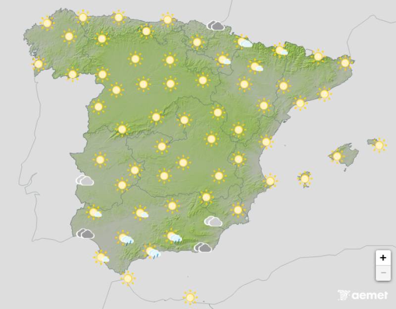
After a very stormy weekend, the weather in northern Spain will settle down on Monday, the instability shifting instead to the south. Here, the day will cloudy bordering on overcast in parts, with a chance of locally heavy showers and thunderstorms in the southwest.
Daytime temperatures will drop on the southern coast of Andalucia and inland areas of the northeast, but they should rise by a degree or two elsewhere.
Tuesday October 28
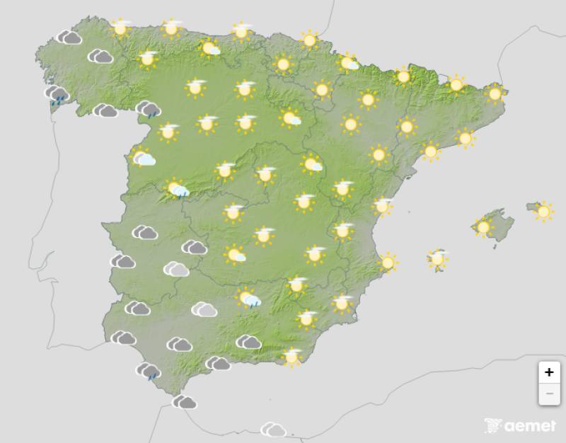
The approaching low in the southwest of the Iberian Peninsula will likely increase cloudiness across the country from southwest to northeast. Rain is expected in the west starting late on Tuesday morning, spreading in a weaker way to central and eastern regions in the afternoon. It will gradually become heavier, particularly in Andalucia, where storms are forecast.
Despite the rain, daytime temperatures will continue to climb.
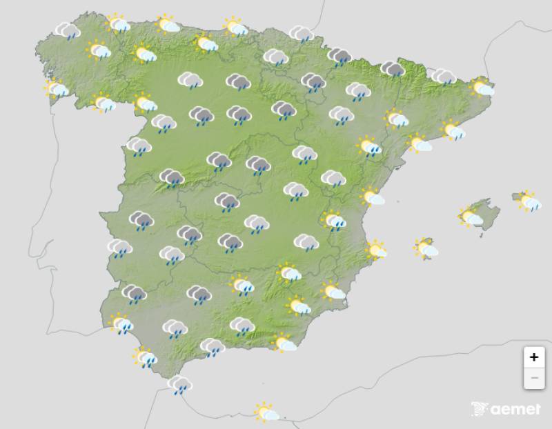
Wednesday October 29

Things will take a turn for the worse on Wednesday with the arrival of another low pressure system. Widespread rain, overcast skies and occasional thunderstorms are expected in the southwest, with Andalucia again bearing the brunt.
Maximum temperatures will finally start to fall although we could see warmer spells in the Balearic Islands. Likewise, Wednesday night should be milder than previous days in most parts.
Thursday October 30
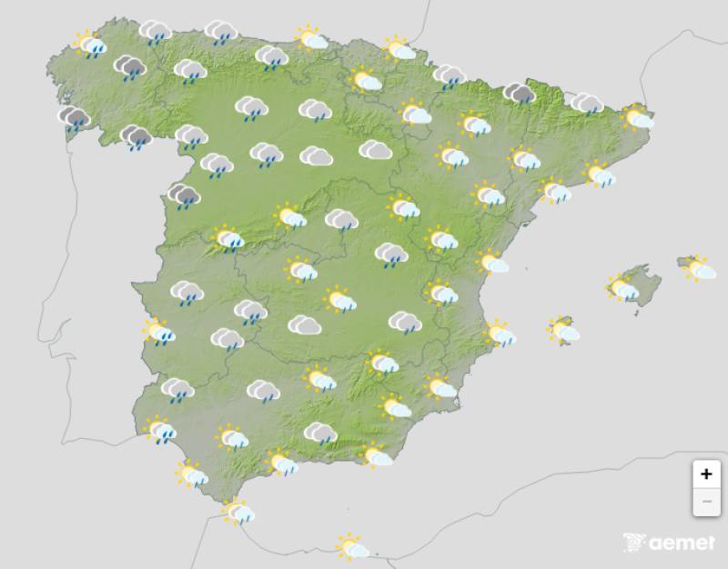
The remnants of the low pressure system that affected the country on Wednesday will move northeast, bringing yet more rain, although it should be considerably weaker.
At the same time, an Atlantic front will enter Spain from the west, resulting in mostly cloudy to overcast skies with showers on the Atlantic coast. This front will move eastward, bringing rain and showers to the western half of the country.
Maximum temperatures will decrease in the northwest and inland southeast, and will increase along the Valencia coast and the Ebro Valley. Minimum temperatures will decrease in the southwest and increase in the northeast.
Join our Spain Weather Watch Facebook group for all the latest weather and climate change news
Images: Aemet


staff.inc.ali
Sign up for the Spanish News Today Editors Roundup Weekly Bulletin and get an email with all the week’s news straight to your inbox
Special offer: Subscribe now for 25% off (36.95 euros for 48 Bulletins)
OR
you can sign up to our FREE weekly roundup!
Read some of our recent bulletins:
Discount Special Offer subscription:
36.95€ for 48 Editor’s Weekly News Roundup bulletins!
Please CLICK THE BUTTON to subscribe.
(List price 3 months 12 Bulletins)
Read more stories from around Spain: