


PROPERTY SEARCH

Winter returns to Spain this weekend: Weather forecast January 15-18
A mass of polar air hovering over Spain will cause a big drop in temperatures of the weekend
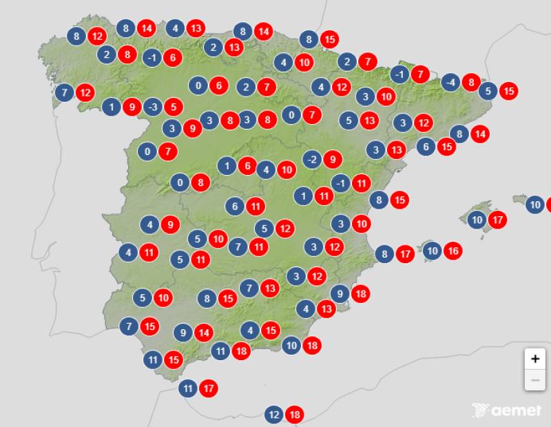
Temperatures forecast on Friday afternoon, January 16
The unsettled weather will return to Spain over the next few days with the arrival of a passing front that’s set to bring rain to large parts of the country. What’s more, on Friday, a polar air mass will descend, resulting in a dramatic drop in temperature and even more rain, which could fall as snow at low to mid-altitudes.
Uncertainty remains high at the moment, but all indications suggest that winter will definitely return to Spain this weekend.
Thursday January 15
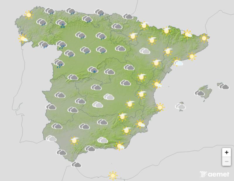
A low-pressure system northwest of Spain along with humid Atlantic winds will bring a day marked by instability, with predominantly cloudy or overcast skies and rain that will hit most of the country at some point.
Temperatures will fall across the board with light frosts expected in the southeast.
Strong gusts of southerly winds have triggered yellow weather alerts in northern Spain.
Friday January 16
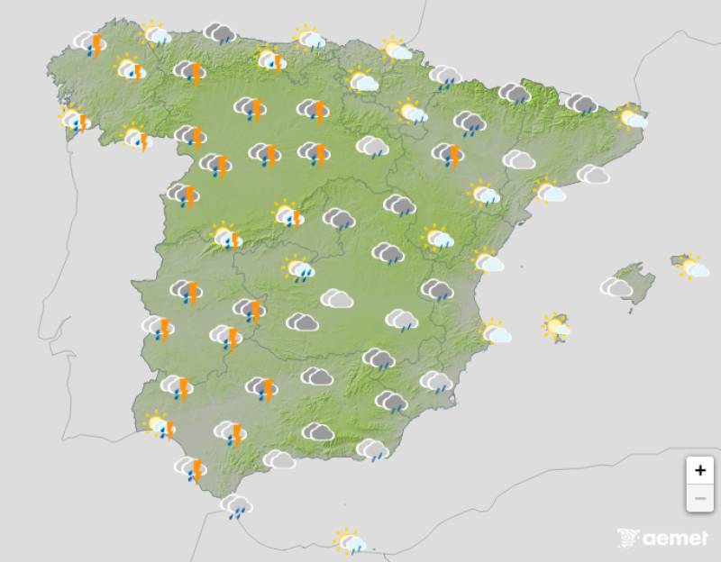
Several different fronts will cross the country on Friday, resulting in mostly grey skies and widespread rain. The showers should be fairly light though, with the exception of some heavy spells on the southern Atlantic coast, and the rain could miss much of the east coast altogether.
The snow level will be around 1000-1400 metres.
Maximum temperatures will drop across eastern Spain with few changes forecast elsewhere.
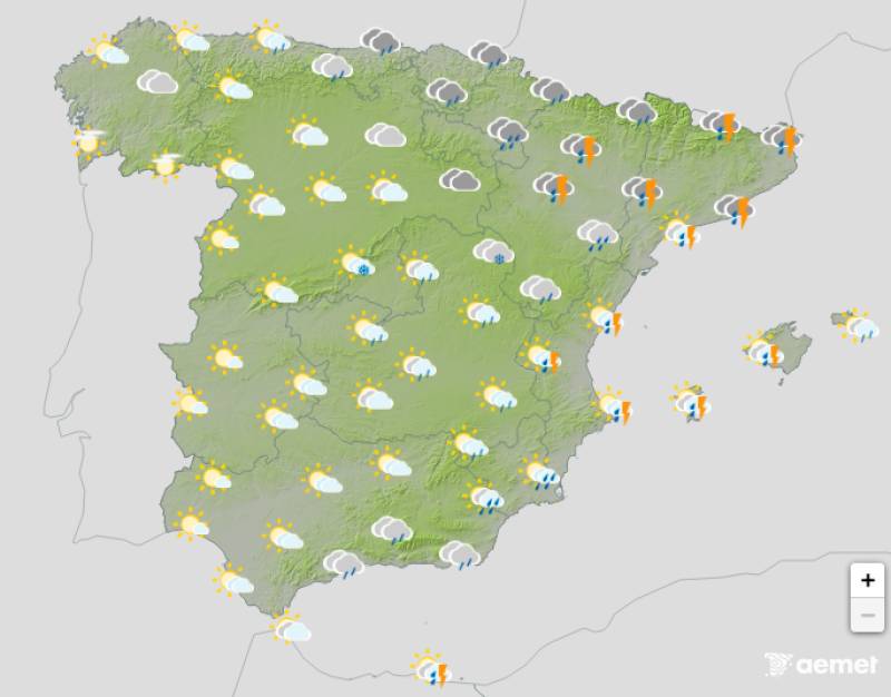
Saturday January 17

The formation of a low-pressure system over mainland Spain and the Balearic Islands will bring cloudy or very cloudy skies to most parts, with rain mainly affecting the coasts and islands.
Snow levels will drop as low as 500 metres alongside generally falling temperatures, which will be most noticeable in the southeast of the country. Saturday night will also be much colder than previous days along the entire west coast.
Sunday January 18
More of the same is expected on Sunday, with dark skies and often heavy rain forecast in northern Spain and along the Mediterranean coast. In the west, however, the skies should remain relatively clear and no rain is predicted.
Night-time temperatures will remain mostly unchanged or rise slightly in the northeast while decreasing in the southwest. However, the mercury should inch up by a couple of degrees at the height of the day.
Join our Spain Weather Watch Facebook group for all the latest weather and climate change news
Images: Aemet


staff.inc.ali
Sign up for the Spanish News Today Editors Roundup Weekly Bulletin and get an email with all the week’s news straight to your inbox
Special offer: Subscribe now for 25% off (36.95 euros for 48 Bulletins)
OR
you can sign up to our FREE weekly roundup!
Read some of our recent bulletins:
Discount Special Offer subscription:
36.95€ for 48 Editor’s Weekly News Roundup bulletins!
Please CLICK THE BUTTON to subscribe.
(List price 3 months 12 Bulletins)
Read more stories from around Spain: