


PROPERTY SEARCH

Storm Emilia brings more widespread torrential rain: Spain weather forecast Dec 15-18
The entire east coast of Spain can expect heavy, persistent rain all week alongside mild temperatures
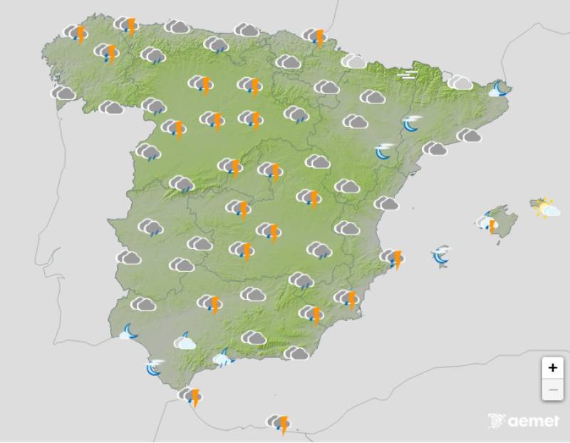
Weather outlook on Tuesday morning, December 16
Storm Emilia barrelled across southern Spain over the weekend, leaving a trail of destruction in its wake. She’s now weakening and moving away but the unsettled weather will continue all week.
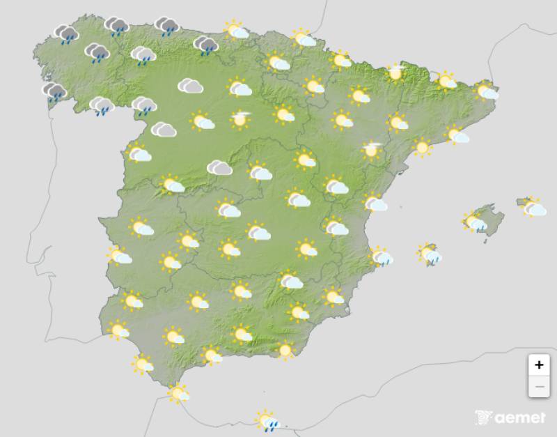
Monday December 15
A new Atlantic front will move n to replace Emilia on Monday, bringing locally heavy rain to the northwest and the Strait of Gibraltar. Cloudy or overcast skies will prevail across the country with widespread showers and stormy intervals forecast. Thunderstorms and even hail showers are expected in the Mediterranean later in the day.
Daytime temperatures will drop long the west coast of Spain and increase slightly in the east of the country.
Weather alerts for heavy rain and storms have been activated in Andalucia, Aragon, Castilla y Leon, Catalonia, Galicia, the Region of Murcia and the Valencian Community.
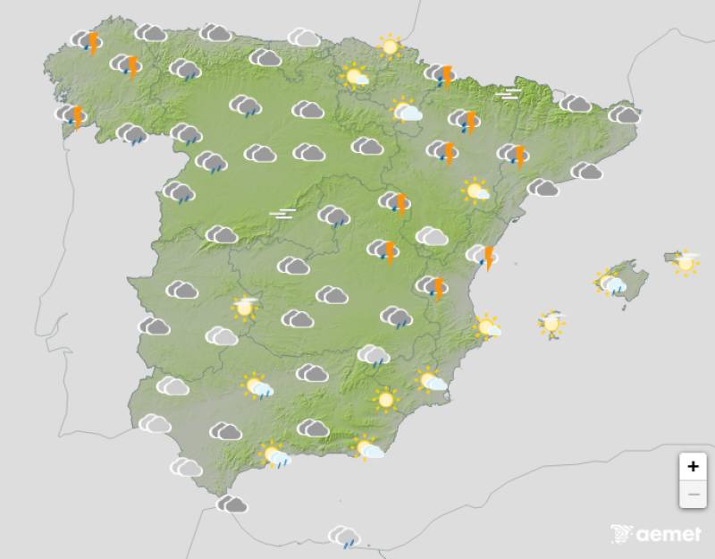
Tuesday December 16
Although its exact path is still uncertain, the State Meteorological Agency (Aemet) expects a low-pressure from the north to head for the Mediterranean on Tuesday. Skies will be cloudy or overcast across the country but there should be some clear spells late in the afternoon. More heavy downpours are expected along the southern Mediterranean coast.
Daytime temperatures will decrease more significantly in the southern half of the country, the Cantabrian coast, the upper Ebro valley, and the southern part of the northern plateau.
Weather alerts for storms remain active in Andalucia, Asturias, Castilla y Leon and Galicia.
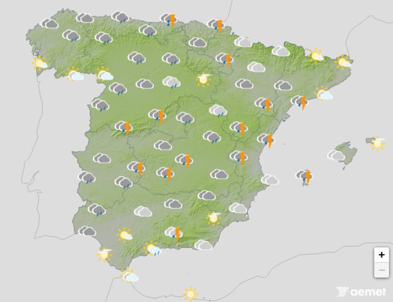
Wednesday December 17
The weather should start to settle down on Wednesday although persistent rain is still likely along the eastern Mediterranean coast and in the Balearic Islands. Partly cloudy skies are forecast elsewhere.
Daytime temperatures are expected to inch up again but Wednesday night will be colder than the rest of the week.
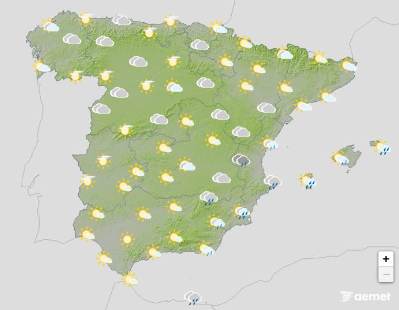
Thursday December 18
The unstable weather will continue in the Mediterranean on Thursday, with yet more rain and overcast skies on the cards, alongside occasional thunderstorms.
A front moving in from the west will gradually cloud the skies in the rest of the country.
Daytime temperatures could dip in central Spin but the mercury should remain fairly steady everywhere else.
Join our Spain Weather Watch Facebook group for all the latest weather and climate change news
Images: Aemet


staff.inc.ali
Sign up for the Spanish News Today Editors Roundup Weekly Bulletin and get an email with all the week’s news straight to your inbox
Special offer: Subscribe now for 25% off (36.95 euros for 48 Bulletins)
OR
you can sign up to our FREE weekly roundup!
Read some of our recent bulletins:
Discount Special Offer subscription:
36.95€ for 48 Editor’s Weekly News Roundup bulletins!
Please CLICK THE BUTTON to subscribe.
(List price 3 months 12 Bulletins)
Read more stories from around Spain: