PROPERTY SEARCH

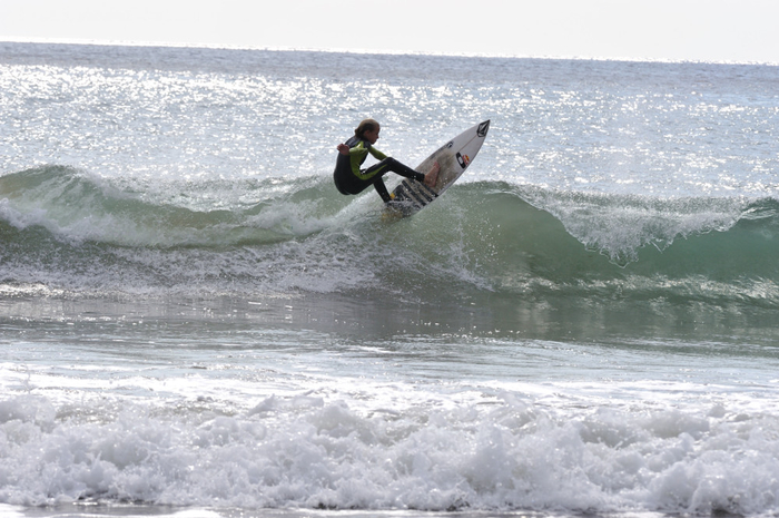
Sporting beaches: Surfing at the Playa del Mojón Mazarrón
A shingle and sand beach on the Mazarrón-Cartagena border which is also popular with surfers
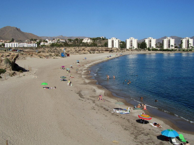
A 450-metre long blue flag beach
The Playa del Mojón is the first beach in the Mazarrón municipality crossing over from the Cartagena border and is on the edge of Isla Plana (Cartagena municipality) and the Puerto de Mazarrón.
It’s often listed as one of the Isla Plana beaches and some guides show it as being within the Cartagena municipality, but it does come under the jurisdiction of Mazarrón.
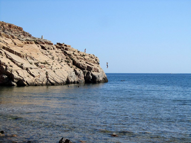
This beach occupies a broad sweeping curve in the Mediterranean coastline and is accessed either via a set of steps at the Mazarrón end or an unmade track at the Isla Plana end next to the five residential blocks on the Cabezo del Mojón.
The first access point is almost opposite the entrance to the Los Delfines Camping Park and comprises a triangular patch of land set back off the E22 coast-road with parking .
In the winter it is possible to drive down the track accessing the beach and park half-way down, but during the summer this is blocked off for use by beach services and lifeguards.
During the summer the car-parking area can become quite crowded, so should this be the case, then continue driving until just before the five apartment blocks at the end of the bay, and you’ll see a dirt track heading off across an area of open ground which leads down to the beach.
There is more parking at this end of the beach, but the track is quite bumpy and the beach stonier, so less popular with sunbathers.
This far end of the beach is easier for those with limited mobility to access as the walk from the car-parking onto the beach is flat (although the beach is scrubbier at this end), whereas the access at the Mazarrón end of the beach is via steep steps from the car-parking area which makes carrying chairs and picnics quite hard work, but takes bathers straight down onto the sand. The ramp can also be used to walk down onto the beach.
However, it’s a nice beach and popular with locals, as it remains fairly low density even in the peak weeks of summer due to the lack of easy parking and also offers some shade due to the height of the cliffs at the back of it.
This is a long beach, measuring 465 metres from one end to the other, with an average width of 50 metres, so there is plenty of space, and although the sand is fine and grey, and the shoreline stony, is well maintained and cleaned regularly during summer.
In the winter the Mazarrón end does accumulate some posidonia deposits, and the shoreline is quite rocky, so bathing shoes are a good idea, although lovers of coloured stones will delight in this beach as the rocks are multi-coloured. The stone fringe along the shores of this beach means that it is less popular as a bathing beach than some of the sandier beaches nearer to the urban town centre of Mazarrón, and as with all of the Mediterranean beaches along this coastline, can be choppy on windy days.
This is a blue flag beach so during the summer is serviced with toilets, footwashes, bins and lifeguard services.
There are no restaurant facilities on the beach for most of the year, although there is generally a beach bar selling basic snacks and drinks during the summer. There are plenty of restaurants, shops and bars, however, in Isla Plana and the Puerto de Mazarrón within a short drive.
There is a bus-stop in the parking area opposite the camping park which runs between the Puerto de Mazarrón and Cartagena. This is the regular route which runs: Cartagena- Cuesta Blanca - La Azohía Isla Plana – Alamillo – Puerto de Mazarrón- Playa grande – Bolnuevo-Mazarrón
For the latest timetable and further information about the Mazarrón municipality go to the dedicated Mazarrón municipality section.(see Tourist info for bus timetables)
Surfing beach
The corner of this beach near to the five apartment blocks and the Cabezo el Mojón is popular with surfers and is a very busy surfing spot when the wind is strong as the waves are large enough for surfers to enjoy a good run-in along the rocky outcrops of the Cabezo and into the corner of the beach.
There are no lifeguards here outside of peak summer season, so particular care should be exercised if sailing between October and June and currents are quite strong further out around the end of the rocky outcrop.
Click for list of all 33 beaches in the Mazarrón municipality
Click for more information relating to the Mazarrón municipality.


staff.inc.ali
Other Mazarrón Beaches