- Region
- Vega baja
- Marina Alta
- Marina Baixa
- Alicante
- Baix Vinalopo
- Alto & Mitja Vinalopo
-
ALL TOWNS
- ALICANTE TOWNS
- Albatera
- Alfaz Del Pi
- Alicante City
- Alcoy
- Almoradi
- Benitatxell
- Bigastro
- Benferri
- Benidorm
- Calosa de Segura
- Calpe
- Catral
- Costa Blanca
- Cox
- Daya Vieja
- Denia
- Elche
- Elda
- Granja de Rocamora
- Guardamar del Segura
- Jacarilla
- Los Montesinos
- Orihuela
- Pedreguer
- Pilar de Horadada
- Playa Flamenca
- Quesada
- Rafal
- Redovan
- Rojales
- San Isidro
- Torrevieja
- Comunidad Valenciana
article_detail
Date Published: 27/02/2024
Reach new heights with the Barranco del Infierno hiking route in Alicante
This trail in the Valencian Community features a challenging climb of 6,600 steps amidst a verdant rocky landscape

Tucked away in the north of Alicante province, the Marina Alta region boasts stunning natural beauty and offers exciting opportunities for outdoor enthusiasts. Nestled within this picturesque setting is the charming town of Vall de Laguar, which serves as the perfect base for exploring the surrounding countryside.
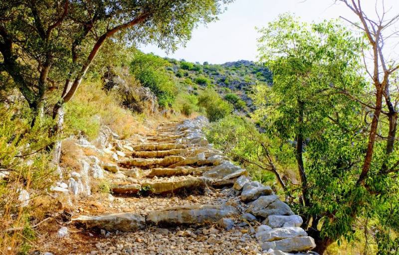
One of the most popular hiking trails in the area is the Barranco del Infierno Route (Hell’s Ravine), also known as the 'cathedral of hiking'. This challenging route features 6,600 steps and takes hikers through a rugged, rocky landscape filled with lush vegetation. The reward for your efforts? Spectacular views from the summit.
Hell’s Ravine
The Hell's Ravine Route, as it's also called, is not for the faint of heart. Spanning 15 kilometres, the hike takes approximately 6 hours and 45 minutes to complete, making it a truly immersive experience. To ensure a safe and enjoyable journey, tourists are advised to wear comfortable shoes, and bring plenty of water, sunscreen and snacks. Early morning is the best time to embark on this adventure, especially during the summer.
Setting off from the town of Fleix, the trail follows the markings of the PR-CV 147 path, leading hikers on an unforgettable journey through the mountains. You'll cross the ravine twice and conquer thousands of stone steps blended seamlessly into the natural surroundings. One of the highlights of this circular route is a unique panoramic view of the mountains and Ebro River, visible through a hole in a large rock.
After reaching the town of Benimaurell, take a moment to rest and recharge before tackling the final leg of the journey – an easy descent back to Fleix.
With its breathtaking scenery and challenging terrain, the Barranco del Infierno Route promises an unforgettable experience for avid hikers and nature lovers alike.
How to get there
For those driving from Alicante city, the journey takes around 1 hour and 15 minutes via the AP-7 motorway.
Image: Wikiloc
staff.inc.ali
Loading
Sign up for the Spanish News Today Editors Roundup Weekly Bulletin and get an email with all the week’s news straight to your inbox
Special offer: Subscribe now for 25% off (36.95 euros for 48 Bulletins)
OR
you can sign up to our FREE weekly roundup!
Read some of our recent bulletins:
Discount Special Offer subscription:
36.95€ for 48 Editor’s Weekly News Roundup bulletins!
Please CLICK THE BUTTON to subscribe.
(List price 3 months 12 Bulletins)
Read more stories from around Spain:
Contact Murcia Today: Editorial 000 000 000 /
Office 000 000 000


