- Region
- Vega baja
- Marina Alta
- Marina Baixa
- Alicante
- Baix Vinalopo
- Alto & Mitja Vinalopo
-
ALL TOWNS
- ALICANTE TOWNS
- Albatera
- Alfaz Del Pi
- Alicante City
- Alcoy
- Almoradi
- Benitatxell
- Bigastro
- Benferri
- Benidorm
- Calosa de Segura
- Calpe
- Catral
- Costa Blanca
- Cox
- Daya Vieja
- Denia
- Elche
- Elda
- Granja de Rocamora
- Guardamar del Segura
- Jacarilla
- Los Montesinos
- Orihuela
- Pedreguer
- Pilar de Horadada
- Playa Flamenca
- Quesada
- Rafal
- Redovan
- Rojales
- San Isidro
- Torrevieja
- Comunidad Valenciana
article_detail
History of Murcia, Part 1
The History of the Municipality of Murcia
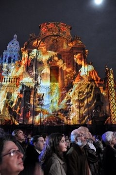 The History of Murcia Capital is written in 6 parts. To access the other sections, click below:
Part 2, Of Romans and Visigoths, Click Romans and Visigoths
Part 3,Moors and Mursiya, Click Mursiya is born
Part 4,Mediaeval Murcia, Click Mediaeval Murcia
Part 5,From 16th to 18th Century, Click Murcia 16th to 18th Century
Part 6, From the end of the 18th Century to the beginning of the 21st, 18th to 21st Centuries
History of Murcia, Part 1, Prehistory
The municipality of Murcia occupies a core, central area of the Region of Murcia, its history dictated by the geographical layout of its landscape and the cultures who occupied it throughout its history.
Broadly speaking, there are three different sets of conditions within the Murcia municipality : the Huerta, the Campo and the mountainous Sierras
The Huerta, with rich soils and abundant water, runs along the valley of the River Segura, while the Campo, with its non-irrigated agriculture and sparser population, lies around it.
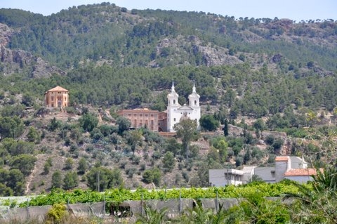 Both areas are delimited by the mountain ranges, or Sierras, which cross Murcia from East to West: Carrascoy, El Puerto, Villares, Columbares, Altaona and Escalona. These form a geographical barrier which has dictated the patterns of settlement since ancient times, and which left the Campo de Murcia practically uninhabited until the Moorish Age.
The first human inhabitants chose the higher ground, looking down onto the lush pastures and marshes of the River Segura valley, now the Huerta, height giving safety, strategic advantage and the ability to see both danger and prey from afar, close enough to water to take advantage of the wildlife it attracted, but out of reach of the floods and above the marshy grounds which abounded thousands of years ago.
And as hunters became farmers, the same lush pasture and rich soil sustained the settlements which grew in these same strategic locations, subsequent cultures leaving their own footprints behind them.
There is no evidence of settlement in what now forms the municipalityof Murcia until around 3000 BC, although there are many other locations within similarly mountainous areas such as Moratalla, Caravaca, Yecla and Cieza which have abundant prehistoric sites.
The first known settlements around Murcia Capital.
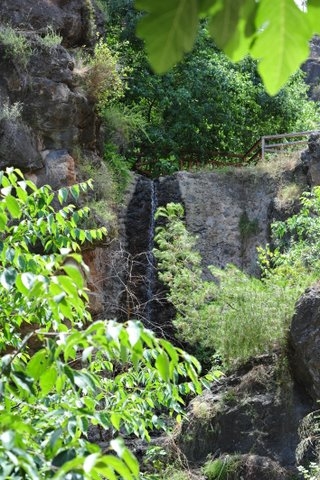 The geography of Murcia mentioned above, made the location of modern day La Alberca one of the most strategically advantageous points above the river valley, and so it could be said that essentially, modern day Murcia began in La Alberca.
Where is La Alberca? Click for map, La Alberca.
Easy to defend, and safe from floodwater, this area had the added advantage of abundant running springwater, providing sustenance without the necessity to descend down to the valley floor. There was abundant firewood, and the natural advantages of the location created opportunity for livestock and agricultural farming.
This area, which is 3 km south of the city of Murcia today, shows the existence of settlement dating from the end of the Neolithic (3rd millennium BC) and as the population grew, spread across into what is now Santo Angel and Algezares, the whole known as the archaeological complex of El Verdolay
Although the lower slopes of La Alberca have been continually inhabited since, important remains have been found higher up the slopes which are the subject of the La Luz visitor centre, behind the sanctuary of the Fuensanta.
These are divided up into three distinct zones, the Monte de Santa Catalina being the main residential zone, the worship areas are on the Cerro de la Luz, and the burial areas are on the Cabecico del Tesoro and the lowest spurs of the hill.
This whole area is now heavily forested and is popular as a recreational area with modern Murcians, the visitors centre of San Antón el Pobre, the Iberian interpretation centre and restaurant of La Luz, and the Monte de Santa Catalina linked by walkways and paths.
The Argarics
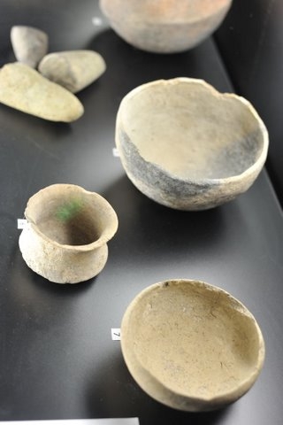 In a nutshell, the development of technology and the manufacture of tools and weapons progressed from the Stone Age to the Iron Age, to the Copper Age and then the Bronze Age. Each progression changed the way mankind developed, enabling him to settle, build and manufacture implements which made agriculture easier.
Although the area was inhabited by 3000 BC, in about the 2nd millenia BC, ie 2000 BC, mankind made huge steps forward as metallurgy developed to allow the casting of bronze alloys.
During this period there were changes in both technology and the way the economy was structured, the most striking innovations being a more intense focus on craftsmanship and the trading of products, especially in the case of sophisticated copper and tin objects. This aspect of Bronze Age society took on an importance which it had never had previously.
Alongside these material changes there were also developments in terms of occupational specialization, ie one person dedicating themselves to baking, and another to carpentry, instead of everyone being a Jack of all trades, which in its turn brought about social differentiation, in other words, a class structure, and these changes created a society with more organization. Some social groups became recognized as being more powerful and important, as can be seen in the grave goods found, the layout of settlements and the hierarchy within them.
This culture began to decline around 1200 BC, some settlements were abandoned, while others survived into the Later Bronze Age, as in the case of La Alberca.
As part of the initial transformation, settlements became bigger, and their defensive structures more complex. The population who flourished in Southern Spain during this period are known as the Argaric culture, (full piece under construction) and lived in the region from 1800BC up until around 1200BC.
In the Murcia municipality, the Argaric culture were attracted not only for the strategic and agricultural reasons already mentioned, but also for veins of ore which have been found in the rocks of both Beniaján and La Alberca.
There is another Argaric settlement in a location called Puntarrón Chico, which is located on a hill 253 metres above sea level in the Sierra de Carrascoy, the first sign of human settlement in what is now Beniaján.
Funeral rituals revealed by the excavation of Puntarrón Chico have the same characteristics as other Argar settlements in the south-east, namely that the burial area is the same as the residential area, the ritual consisted of individual burial, and the corpse was placed lying on its side and hunched, inside a box made of large flagstones.
The Iberian Culture .
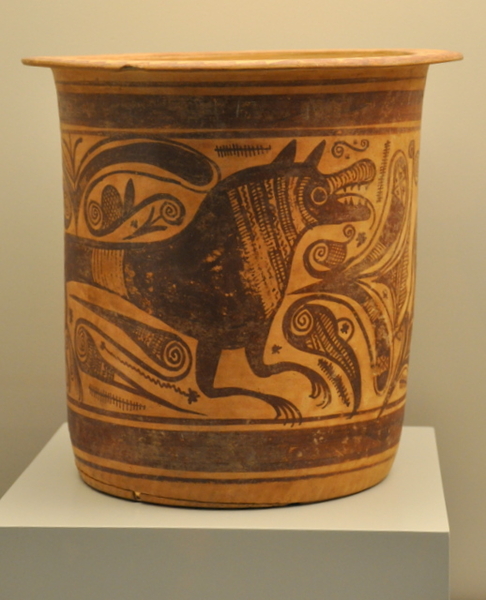 The next definable population to follow from the Argarics were the Iberians. ( Click Iberians.)This culture flourished between 525 BC and the arrival of the Romans in 209BC, disappearing as a separate, definable culture by about 50BC when the whole region became totally romanised.
The definition of the Iberians came with their metallurgical skill and in the years prior to their establishment as a culture, they developed important trading and cultural links with other Mediterranean peoples, working along the coast of Murcia such as the Phoenicians,( Click Phoenicians) the Carthaginians and the Greeks, who brought in new technology, new ideas, new influences.
The Iberians followed on from the Argarics and continued to live at El Verdolay, which by this point had expanded to include La Alberca, Santo Angel and Algezares, building their own substantial structures, including the Necrópolis of the Cabecico del Tesoro and the Estación Serícola, the Santuario de la Luz and Santa Catalina.
By this point, burial practices had changed, as had the manner of worship and this area became the focal point of religious practises as the population spread on the lower slopes of the valley.
High on the hillside above La Alberca, the Iberians built the Santuario de la Luz, a religious complex in which numerous votive offerings have been found, as well as the marble limestone head of the goddess to whom the temple was dedicated, Demeter.
This is the Centro de Visitantes de la Luz, and offers spectacular views down over the outskirts of the city, and sitting on the restaurant terrace with a cup of coffee, it is easy to see why this location was the birthplace of the modern city which lies at its feet today.
Monteagudo, a Bronze Age settlement.
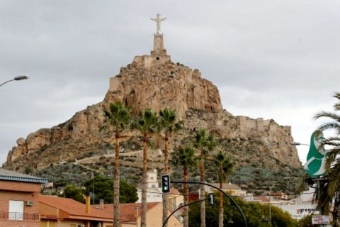 Another area of strategic importance and important settlements is Monteagudo, which is on the opposite side of modern Murcia, close to the border with Alicante and Orihuela.
Monteagudo is well known for its enormous figure of Christ, which towers over the Murcian huerta, built on top of a strategic outcrop and inside an impressive Moorish fortification.
Monteagudo is on the left bank of the River Segura, and looks out over the Vega Baja, with good natural resources, close to running water and for this reason its strategic characteristics were enormously advantageous for the Bronze Age settler. The Argaric bronze Age culture are known to have been in this area between 1700 and 1200BC and the site has been continually inhabited as far as we know, from the Bronze Age until today.
Contact Murcia Today: Editorial 000 000 000 /
Office 000 000 000


