


PROPERTY SEARCH

A week of rain: Spain weather forecast May 12-15
Many parts of Spain can expect hailstorms at least until Thursday
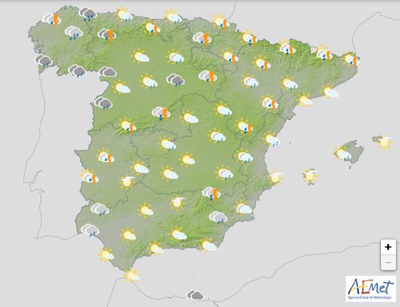
Weather outlook on Wednesday May 14
Just like the past weekend, this week’s weather across Spain will stay unsettled, with rain and storms likely in many areas until at least Thursday. A mix of cold air high up in the atmosphere and moisture on the ground will keep stormy conditions going, especially in the northwest and central parts of the country.
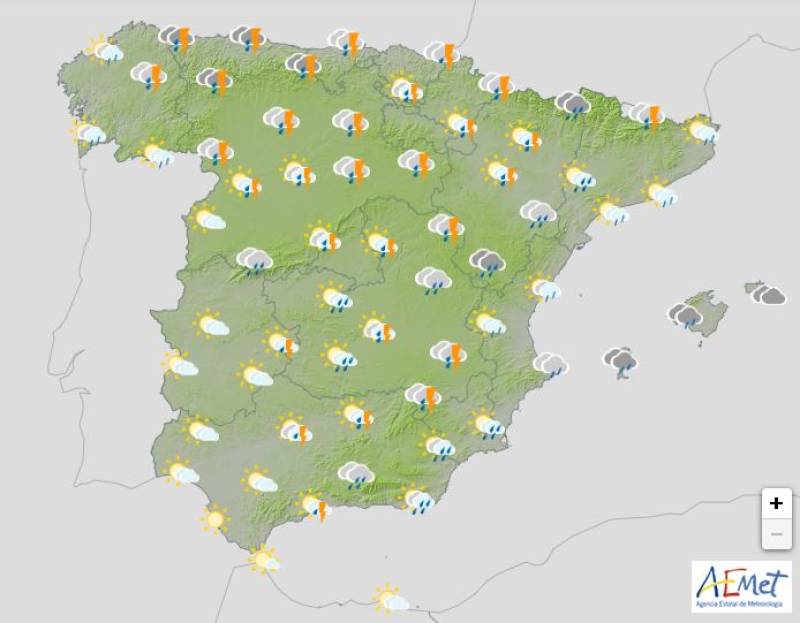
On Monday May 12, a pocket of cold air will move across the northern half of the country. Combined with the humidity at the surface and the already damp ground from the weekend rain, this will encourage storm clouds to form over much of inland Spain.
Weather outlook on Monday May 12
The State Meteorological Agency (Aemet) has issued yellow alerts for heavy rain in parts of the northern Balearic Islands, and more warnings may be added in northern inland regions later in the day.
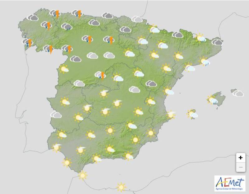
The storms will become more widespread from Tuesday May 13, spreading at first to the east of the country, but the worst of the weather will remain confined to northern Spain.
The heaviest downpours are expected from the Pyrenees and upper Ebro Valley to the Iberian and Penibético mountain ranges, where storms could be especially intense.
Aemet has activated yellow rain and storm warnings in the Valencian Community, Aragon, Castilla-La Mancha, Catalonia, the Region of Murcia and Navarra.
Weather outlook on Tuesday May 13
Wednesday and Thursday, May 14 and 15, will likely continue the trend of scattered showers and storms, particularly in the northwest and central Spain. However, there are signs that conditions might begin to calm toward the end of the week, as a high-pressure system slowly approaches, bringing more stable weather.
But during the first half of the week, some areas could see significant rainfall totals, especially in Galicia, Asturias, Castile and León and the Pyrenees, with more than 70 litres per square metre possible in some spots. The Balearic Islands, particularly the central and southeastern parts, may also see a spike in rainfall midweek.
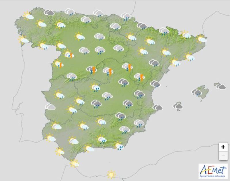
Weather outlook on Thursday May 15
Temperatures during the first half of the week will be lower than usual for this time of year. In cities on the northern plateau, morning lows might dip to around 10°C. Meanwhile, southern areas, the Mediterranean coast and the Canary Islands will be much warmer, with highs reaching or topping 25°C in places like Valencia, Murcia, Palma, Sevilla, Córdoba, Santa Cruz de Tenerife and Las Palmas de Gran Canaria.
As we move into the weekend, from Friday through Sunday, temperatures should start to rise again, though not to extreme levels.
Join our Spain Weather Watch Facebook group for regular weather and climate change updates
Images: Aemet


staff.inc.ali
Sign up for the Spanish News Today Editors Roundup Weekly Bulletin and get an email with all the week’s news straight to your inbox
Special offer: Subscribe now for 25% off (36.95 euros for 48 Bulletins)
OR
you can sign up to our FREE weekly roundup!
Read some of our recent bulletins:
Discount Special Offer subscription:
36.95€ for 48 Editor’s Weekly News Roundup bulletins!
Please CLICK THE BUTTON to subscribe.
(List price 3 months 12 Bulletins)
Read more stories from around Spain: